Difference between revisions of "Alnwick Moors"
Jump to navigation
Jump to search
| (14 intermediate revisions by 2 users not shown) | |||
| Line 1: | Line 1: | ||
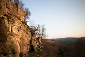
| − | + | [[File:Corbys_Crag.jpg|alt=|thumb|A climber on Corbys Crag.]] | |
| − | + | This section covers large areas of moorland to the west of Alnwick, south of the B6348 road from Wooler eastwards through Chatton. The rock is all Fell Sandstone, of variable quality from the absolutely perfect at Hangmans Rock to the soft and sandy at Caller. With the exception of the two quarries in the area, the atmosphere is classic Northumbrian, with stunning views west to the Cheviots, beautiful sunsets and acres of wilderness to get lost in. The southern most part of these moors, around Corby's Crag, is on the West to North facing slopes of Bigges Pillar, and the crags in this area take a lot of drainage from the hillside and dry slowly. | |
| − | + | {{#display_map:center=Alnwick | |
| − | + | | gkml=https://northumberlandclimbing.co.uk/Maps/E05009093.kml | |
| + | | zoom=8 | ||
| + | }} | ||
{| class="wikitable" | {| class="wikitable" | ||
| − | |Beanley | + | |[[Beanley]] |
|- | |- | ||
| − | |Caller Crag & Boulders | + | |[[Caller Crag & Boulders]] |
|- | |- | ||
| − | |Corby's Bridge | + | |[[Corby's Bridge]] |
|- | |- | ||
| − | |Edlingham | + | |[[Edlingham]] |
|- | |- | ||
| − | |Harehope Quarry | + | |[[Harehope Quarry]] |
|- | |- | ||
| − | |Hunterheugh Crag | + | |[[Hunterheugh Crag]] |
|- | |- | ||
| − | |Redheugh | + | |[[Redheugh]] |
|- | |- | ||
| − | |Widehope | + | |[[Widehope]] |
|- | |- | ||
| − | |Boyes Quarry | + | |[[Boyes Quarry]] |
|- | |- | ||
| − | |Corbies Fortress (Corbies Crag) | + | |[[Corbies Fortress (Corbies Crag)]] |
|- | |- | ||
| − | |Corbys East | + | |[[Corbys East]] |
|- | |- | ||
|Harehope Canyon (Dove Crag) | |Harehope Canyon (Dove Crag) | ||
Latest revision as of 06:30, 8 October 2020
This section covers large areas of moorland to the west of Alnwick, south of the B6348 road from Wooler eastwards through Chatton. The rock is all Fell Sandstone, of variable quality from the absolutely perfect at Hangmans Rock to the soft and sandy at Caller. With the exception of the two quarries in the area, the atmosphere is classic Northumbrian, with stunning views west to the Cheviots, beautiful sunsets and acres of wilderness to get lost in. The southern most part of these moors, around Corby's Crag, is on the West to North facing slopes of Bigges Pillar, and the crags in this area take a lot of drainage from the hillside and dry slowly.
| Beanley |
| Caller Crag & Boulders |
| Corby's Bridge |
| Edlingham |
| Harehope Quarry |
| Hunterheugh Crag |
| Redheugh |
| Widehope |
| Boyes Quarry |
| Corbies Fortress (Corbies Crag) |
| Corbys East |
| Harehope Canyon (Dove Crag) |
| Hepburn Woods |
| Oxen Wood |
| White House Rocks |
| Blaewearie |
| Cloudy Crags |
| Corbys Crags |
| Hangmans Rock |
| Heckley |
| Lemmington Woods |
| The Mount |
